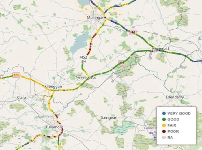
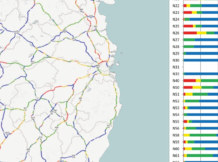
Our road surveys are carried out by trained professionals who will inspect road conditions, collect data and plan for future improvements.
With a focus on safety and sustainability, our team take a thorough and meticulous approach to creating road surveying reports. We ensure our critical approach is balanced by actionable improvements that will help increase the safety of drivers. With over 50 years’ experience and a commitment to excellence, our road surveys offer local and municipal authorities long-lasting improvements that ultimately help save lives.
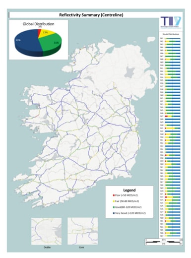
ROAD MARKING REFLECTIVITY SURVEYS
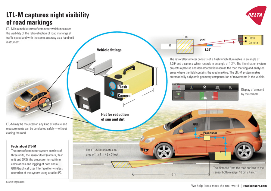
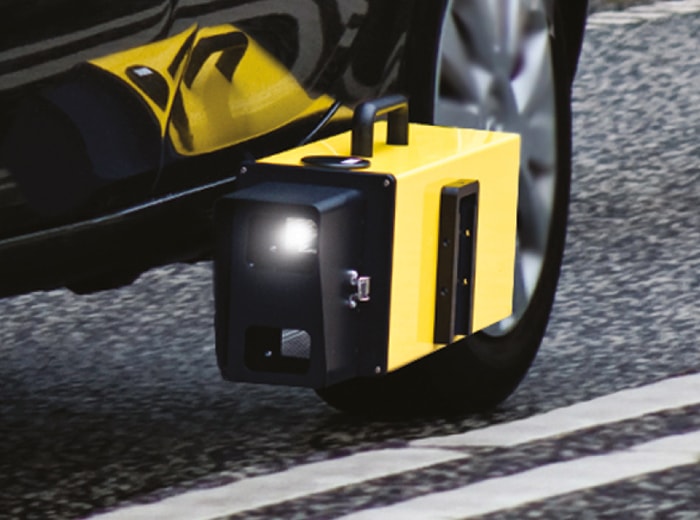
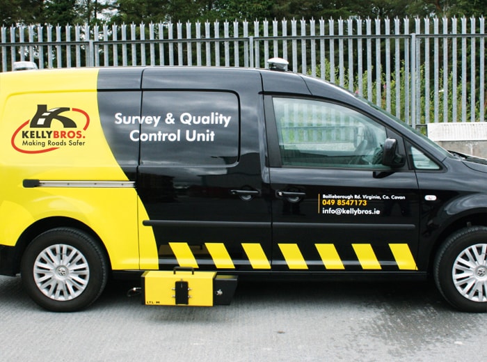
With our focus on innovation, Kelly Bros have helped develop a new system that streamlines the survey process by integrating a state-of-the art reflectivity camera, a sub-metre GPS, as well as customised software. By using these products in tandem it is possible to transform a laborious manual data collection, that could take weeks, into an efficient process that takes only a matter of hours.
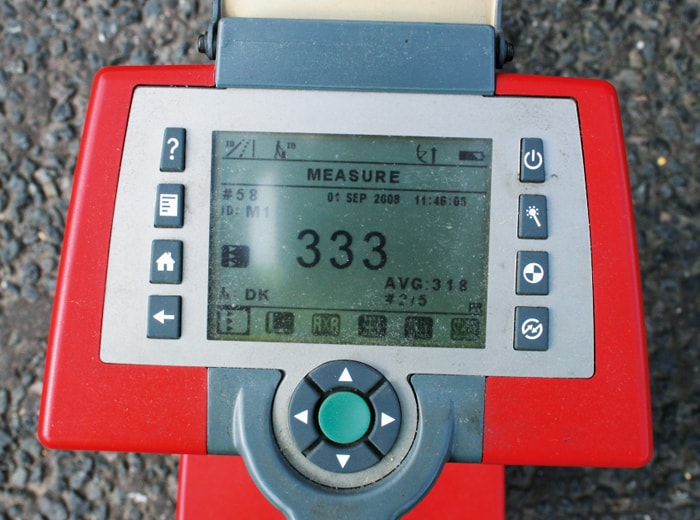
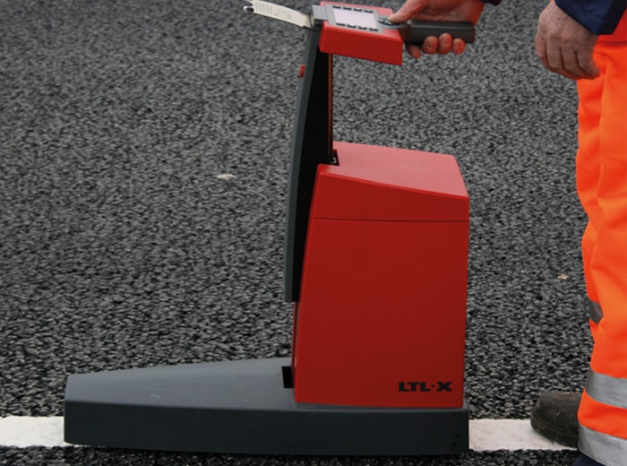
Kelly Bros use new Delta LTL-M technology to ensure the highest accuracy in our reflectivity surveys.
The Delta LTL-M is a mobile retroreflectometer which measures the visibility of the retroreflection of road markings at traffic speed and with the same accuracy as a handheld instrument.
The Delta LTL-M technology enables surveys to be conducted without closing the road, or putting crews and the general public at risk on the road. This technology is a part of delivering our commitment to making roads safer.
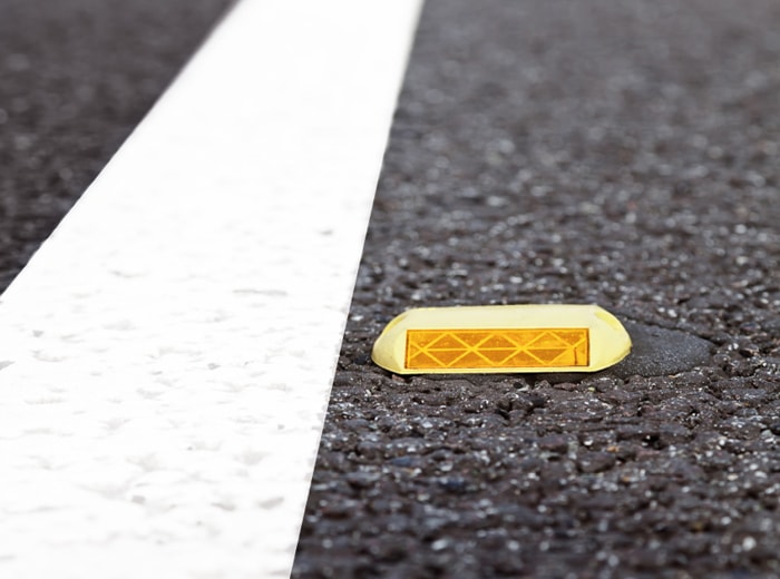
CAT’S EYE REFLECTIVITY SURVEYS
With increasing volumes of traffic, road studs are subject to a far higher level of pressure which can have a significant impact upon their reflectivity as well as the durability of their rubber mounting and steel setting. Whilst current legislation requires that they are monitored annually, the present methods used are time consuming, require the introduction of a number of traffic management systems and lack integration between the positional and attribute information collected.
We use the latest technology to photograph each road stud and gather accurate insight, with data designed to create meaningful reports over large areas. Thanks to the technology embedded within the camera, all the images are blur free and each defect is attributed a circle symbol for reflectivity, a triangle symbol for a defect and then colour coded according to the urgency of the work required. The information can then be presented on a Google Earth map, helping the local authorities and national agencies see how the road studs are performing in a particular area. Data pertaining to each individual road stud, including a position and an image, are stored on an Excel spreadsheet so that reports can be easily created.
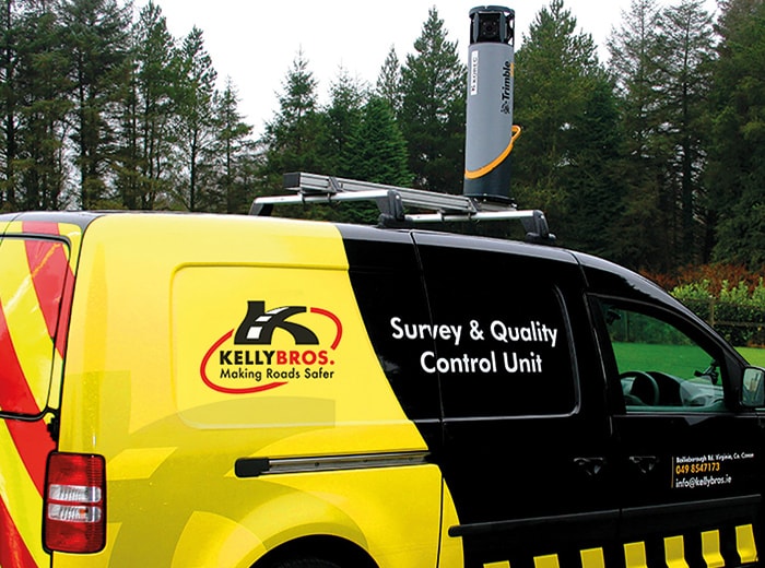
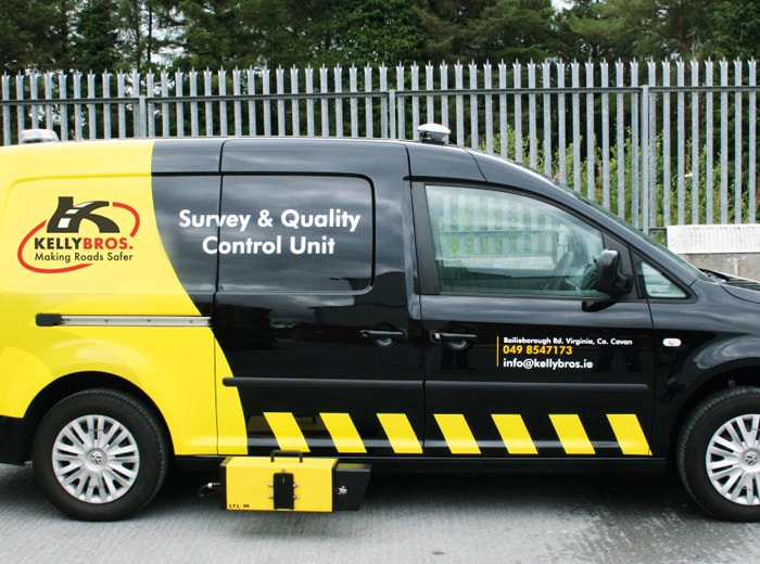
360 DEGREE IMAGING SURVEYS
We are able to conduct 360 degree image surveys using the Trimble MX7. Requiring only a single operator, it can be used for a range of applications tailored to the needs of engineering consultants and local authorities. These applications range from road condition surveys and asset data collection to the documentation of site conditions and the recording of bridge clearances.
Released at the end of 2015, the Trimble MX7 can be mounted on a range of vehicles. It enables users to capture high quality 360 degree, 30 megapixel geo-referenced images at highway speeds through a clear and intuitive user interface. The Trimble Trident offers specialised software for data capture, extraction and analysis that can be used for a number of deliverables including documenting accurate measurements and producing pictorial records.